by Bethany Blankley
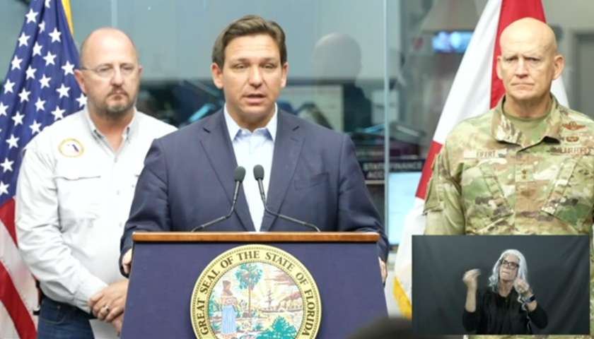
Florida Gov. Ron DeSantis issued new warnings Monday ahead of Hurricane Ian, expected to make landfall this week. It was upgraded from a tropical storm to a Category 1 hurricane Monday morning and is projected to strengthen to a major hurricane.
As of 11 am Monday, the storm was located roughly 375 miles south of Key West. It’s moving about 15 miles an hour north with maximum winds of 80 miles an hour. As it moves into the Gulf, it’s expected to strengthen into a major hurricane as early as Tuesday, DeSantis said.
“It will bring heavy rains, strong winds, flash flooding, storm surge, along with isolated tornado activity along Florida’s Gulf Coast,” he said. Florida should brace for a large hurricane he said, the diameter of the hurricane is roughly 500 miles wide.
“You will see storm surge in southwest Florida,” he said, “even though the storm is projected to be a hundred miles off the coast.”
Some counties have begun evacuations, he added, with more to come.
He said Floridians should visit FloridaDisaster.org/PlanPrepare to get the most up to date information about evacuation zones.
The state Department of Economic Opportunity has activated a hotline to assist Floridians: 850-815-4925, and provided storm information at www.FloridaDisaster.biz.
The state Department of Education is updating its website with county school closures at fldoe.org/storminfo.
Floridians are encouraged to use FL511.com or download the app to stay informed about roadway conditions during emergencies.
The state has issued the following warnings and watches:
- Tropical Storm Warnings are in effect for the Lower Keys, from the 7 Mile Bridge southward to Key West, and the Dry Tortugas.
- Tropical Storm Watches are in effect for portions of the Florida Gulf Coast stretching from Englewood to Chokoloskee, including Charlotte, Collier, and Lee counties.
- A Hurricane Watch is in effect for Englewood to the Anclote River, including Tampa Bay.
- Storm Surge Watches are in effect for the Florida Keys and mainland Monroe County, as well as far southern Miami-Dade, Collier, coastal Lee, the Tampa Bay area and coastal Charlotte counties.
- Storm surges are expected to reach between 5 and 10 feet in Anclote River to Longboat Key including Tampa Bay; from 5 to 8 feet in Longboat Key to Englewood; from 4 to 7 feet in Englewood to Bonita Beach; from 3 to 5 feet in Bonita Beach to East Cape Sable; from 2 to 4 feet from East Cape Sable to Card Sound Bridge, including Florida Bay; and from 2 to 4 feet in the Florida Keys including the Dry Tortugas.
Multiple state agencies are activated and prepared for disaster response.
So far, 5,000 Florida Guardsmen have been activated to State Active Duty and pre-positioned at armories. Another 2,000 Guardsmen from Tennessee, Georgia and North Carolina have also been activated to provide assistance.
The Florida Division of Emergency Management is overseeing resource requests coordinating the delivery of trucks of food and water, generators, and water pumps among other supplies; roughly 360 trailers have been loaded with over two million meals and over one million gallons of water for distribution. It’s also coordinating with 67 county emergency management offices to provide services; more than 25,000 utility linemen are staged and prepared for power restoration efforts.
The Florida Department of Health is coordinating with 67 county health departments and county emergency managers and other state agencies, and has deployed nearly 300 ambulances, paratransit buses, and support vehicles. Nearly 100 people working in medical teams are also on standby in Orlando, Atlanta, and Warner Robbins Air Force Base in Georgia.
The state Agency for Health Care Administration is requiring health providers to update the Health Facility Reporting System for 10 a.m. daily reports that all operating long-term care facilities have a generator on-site.
The state Department of Veterans Affairs has closed certain locations for in-person and procedure appointments. The Bay Pines VA Healthcare System closed the C.W. Bill Young VA Medical Center Monday through Thursday, including its Emergency Department. The North Pinellas and St. Petersburg VA Clinics will be closed Wednesday and Thursday. The Sarasota, Bradenton, and Port Charlotte VA Clinics will be closed Wednesday.
The state Department of Transportation has suspended tolls on Polk Parkway in Polk County, Suncoast Parkway in Pasco, Hernando, and Citrus counties, Veterans Expressway in Pasco, Hernando, and Citrus County, I-4 Connector in Hillsborough County, Selmon Expressway in Hillsborough County, Pinellas Bayway in Pinellas County, Sunshine Skyway Bridge in Pinellas County, Garcon Point Bridge in Santa Rosa County, Spence Parkway in Okaloosa County, Mid-Bay Bridge in Okaloosa County and Alligator Alley in Collier and Broward counties.
SunRail corridor services will be discontinued Tuesday to tentatively resume Friday.
FDOT has waived standard weight restrictions for commercial vehicles transporting fuel, emergency equipment, services, supplies, and agriculture commodities and citrus. It’s also putting in place a number of safety measures, coordinating with the Florida Highway Patrol, other law enforcement agencies, and Georgia DOT, working with utility providers and coordinating with the U.S. Coast Guard.
Florida Fish and Wildlife Conservation Commission officers in all 67 counties are readied with multiple water, land and air equipment and vehicles for deployment.
– – –
Bethany Blankley is a regular contributor to The Center Square.
Photo “Hurricane Ian” by Ron DeSantis.


